- West Coast Trail Journal
- West Coast Trail – Planning
- West Coast Trail – Packing List
- West Coast Trail Day 1: Pachena Bay to Darling River
- West Coast Trail Day 2: Darling River to Tsusiat Falls
- West Coast Trail Day 3: Tsusiat Falls to Carmanah Creek
- West Coast Trail Day 4: Carmanah Creek to Camper Bay
- West Coast Trail Day 5: Camper Bay to Thrasher Cove
- West Coast Trail Day 6: Thrasher Cove to Gordon River
Previous entry: Day 1 – Pachena Bay to Darling River
Journal entry for August 13, 2010
Approximate distance hiked: 6.8 miles, 11 km

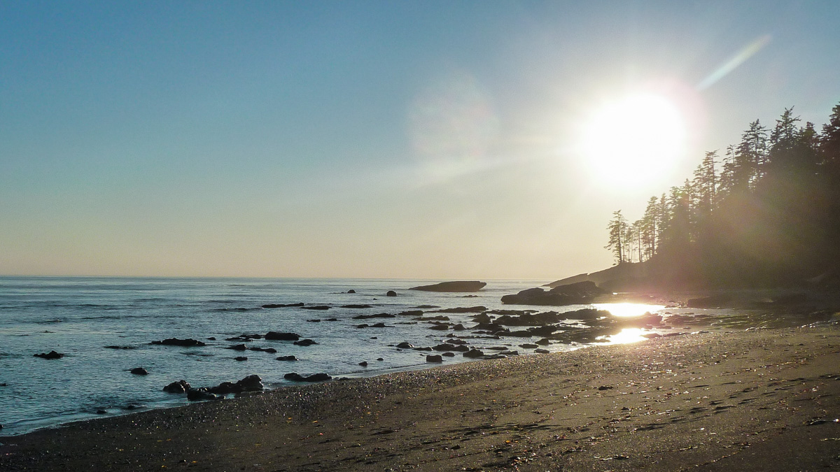
After sleeping very well, I woke up a little bit after 9am. The fog had cleared and the weather was great, and I spotted a couple of whales deep in the sea. They were hard to spot from a distance though. Looking south, I could see the Olympic Peninsula.
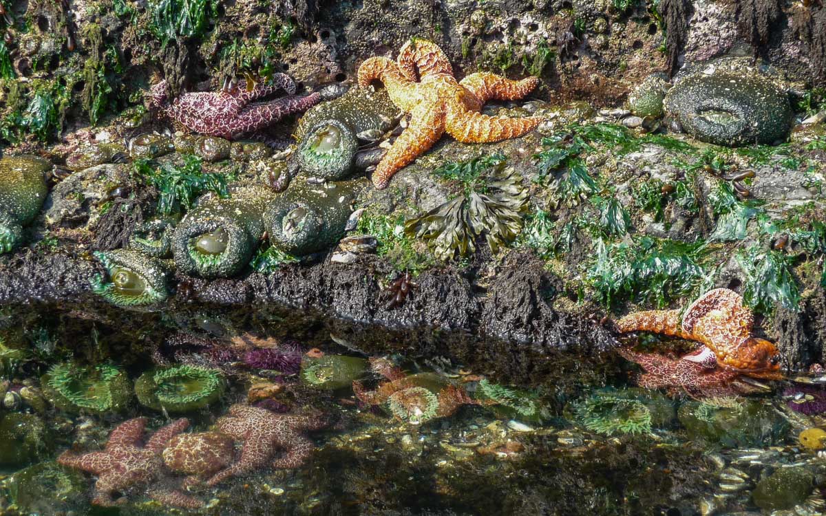
The tide was low so I tried to walk a little bit closer to the sea to get a better look of the whales. While going there, I found a bunch of tide pools with lots of starfish in them.
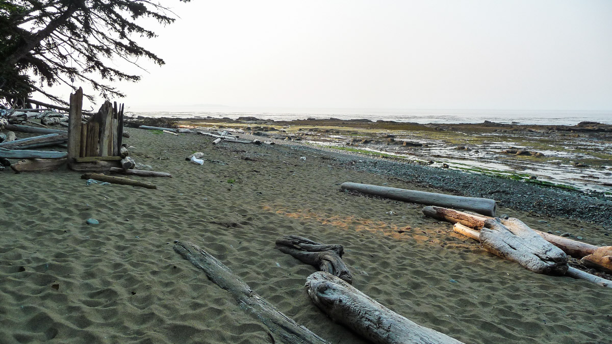
The first 2 1/2 km out of Darling River campsite is all beach hiking. At the end of this section there was what looked like a ranger station, and right by it, part of a shipwreck.
I joined the trail inland and crossed Tsocowis Creek by bridge.
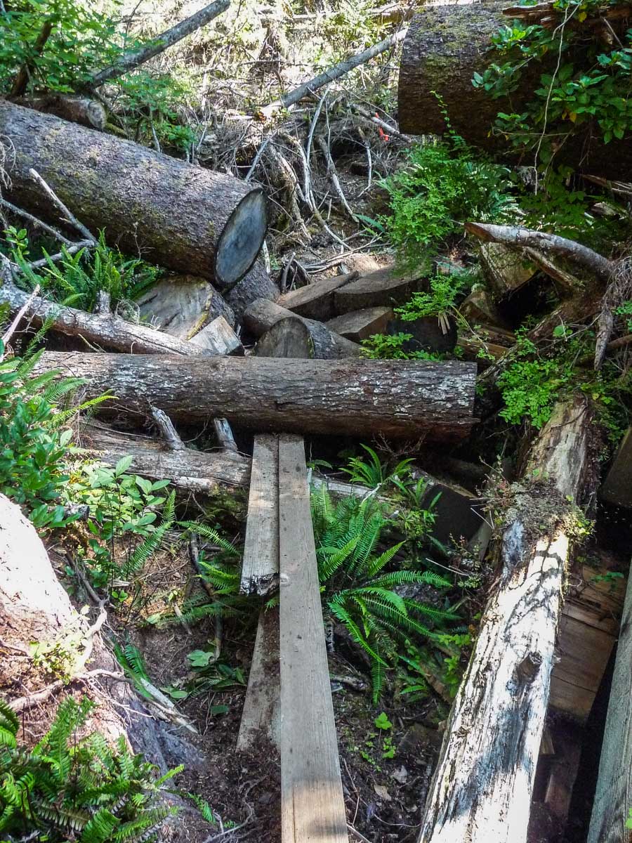
The terrain became more rugged than the previous day.
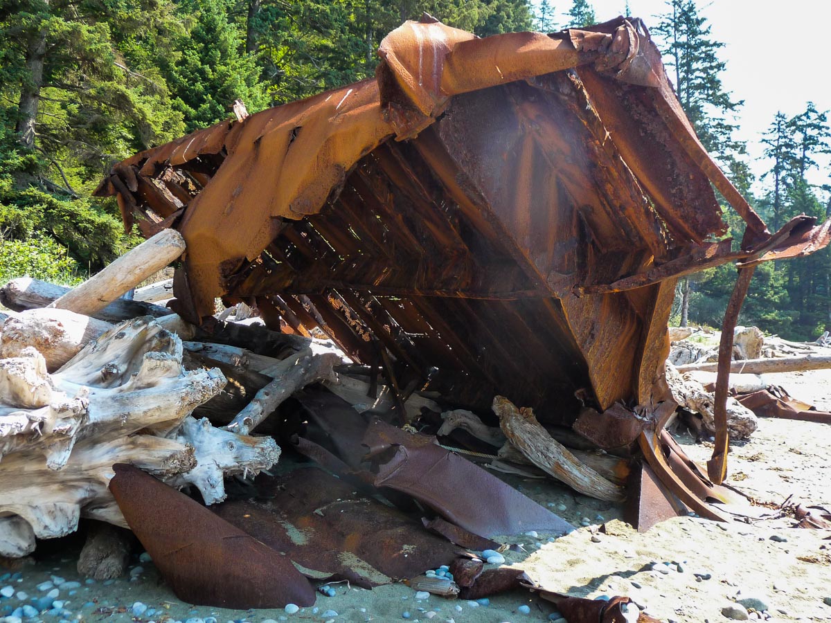
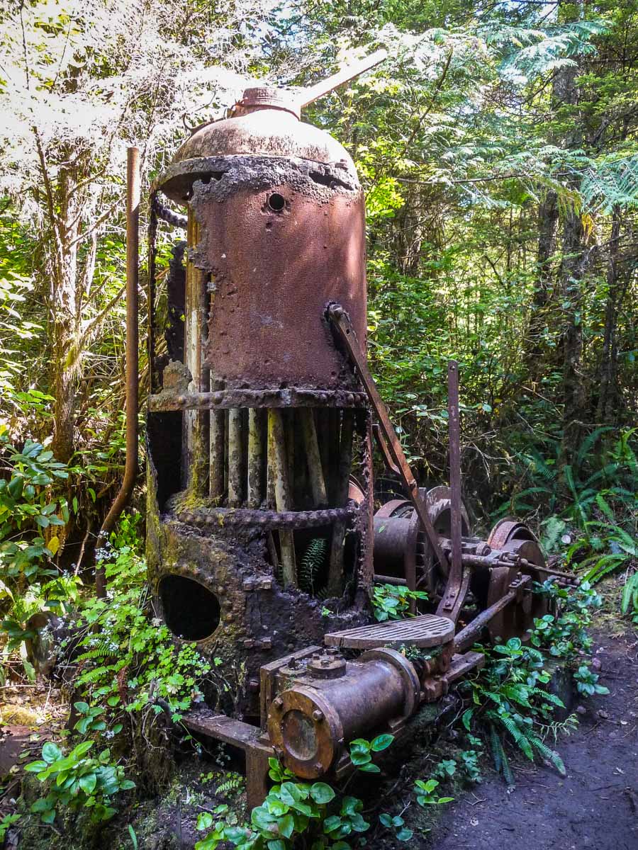
I stayed for a while at the Valencia Bluffs lookout, searching for the remains of a shipwreck but found nothing. Maybe it was due to the high tide at the moment. Moving on, I found a “grader” next to the trail.
I rejoined the beach around km 20. The temperature was high and the sun was punishing with the absence of shade. The following 3 km to Klanawa River is all beach hiking. One section is only passable at tides below 2.7m. Since the tide was rising quickly, I wondered for a moment if I was going to get caught by it. I ended up managing just fine.
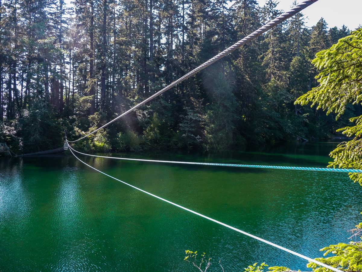
I could have easily forded Klanawa River through the beach, but this one my first chance to use one of the cable cars.
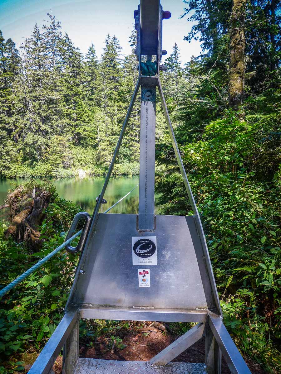
The cable car was a lot of fun. It stops halfway, and you have to pull the cable the rest of the way to reach the other side. I would recommend using gloves for this.
The next 2 km or so to Tsusiat Falls are inland and mostly on boardwalks. In some sections, the boardwalks were either slippery, and/or in pretty bad shape. There is a nice lookout point with a bench to sit on. I was told to look for whales there, but couldn’t find any during my 20 minute break.

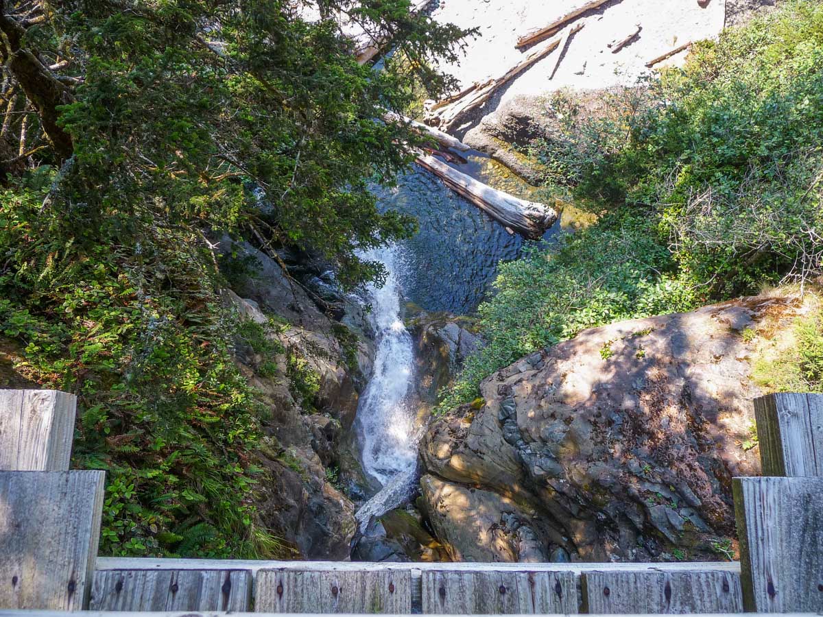
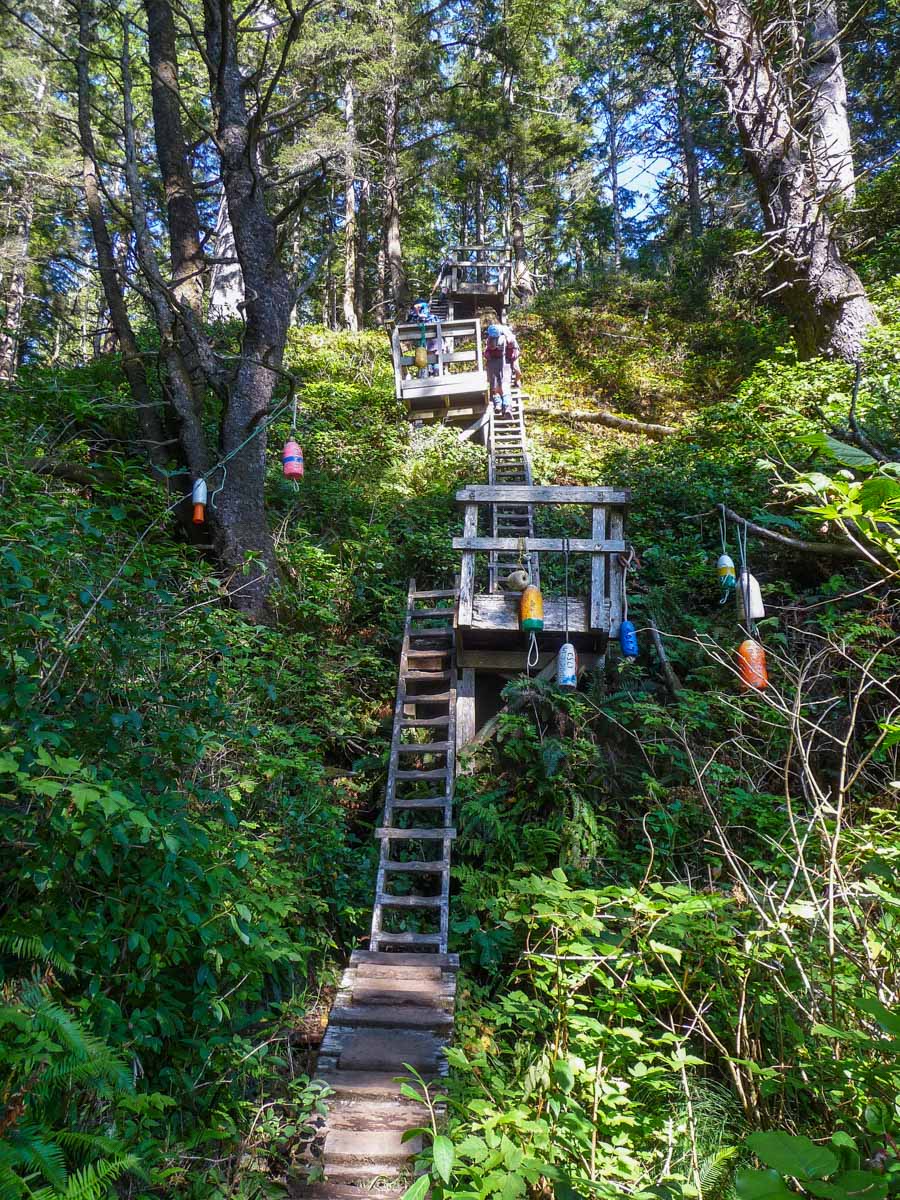
There is a nice set of ladders right before Tsusiat Falls.
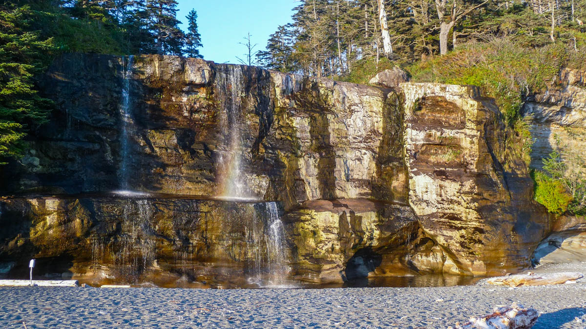
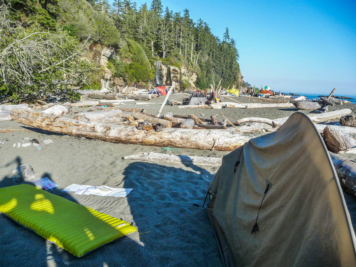
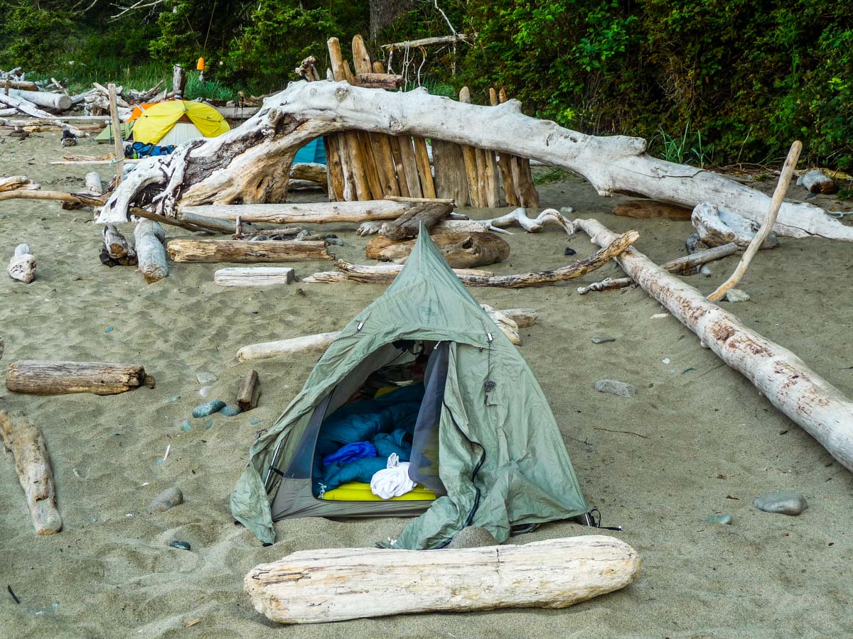
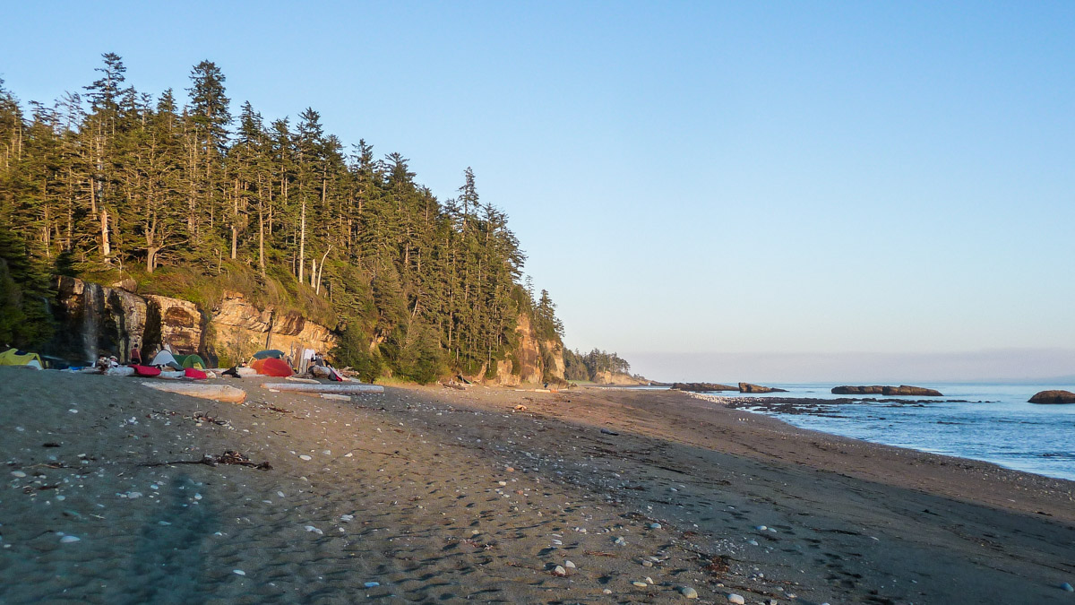
There were already a good number of people at the campsite when I got there around 5pm. It is a huge campsite though, with plenty of space for lots of tents. I pick a spot right next to Nick and Lorna, who I had met the previous day. Since it was late in the summer, the water stream coming down the falls was somewhat weak. It was still perfect for the nice shower I took underneath it.
I met Stephan from Germany, who was doing the hike in the opposite direction. He was one of the few solo hikers I met on the WCT. I’d later run into him again at the hostel in Victoria.
The weather was beautiful. I ate dinner with Nick and Lorna. I learned that Nick is a writer and Lorna is an actress. They were visiting the area and decided in the last minute to do the WCT, although only half of it. Their hike was ending the next day at Nitinah Lake. We shared a campfire and stayed outside well after it got dark.
Next Entry: Day 3 – Tsusiat Falls to Carmanah Creek
Part of the West Coast Trail Journal and Pacific Northwest Trip Journal

Comments (4)
Nice trip report it brings back a lot of memories.
The grader is not from a shipwreck but was brought in from the north end of the trail. The original plan was to build a rescue road to reach shipwreck victims and they started building it from the north end but I think they found the terrain a little overwhelming for road building.
The steam engine is called a donkey engine and may have been used for logging or building the road. The steam engine would have been attached to large trees with a long cable and would pull its self to the tree, attach to another tree and repeat.
Thanks Steve for the info. I had no idea what these artifacts were for. I’ll edit my post shortly.
Hi Kevin I was looking up some information for the hike, and I found your blog very helpful. What would you suggest for hikes to do in preperation?
I don’t know where you live so it’s hard for me to recommend. But expect a lot of mud so if you can find muddy trails to train on, that would be great. Beach hiking can also help, while carrying your full weight. But the most important thing is to have a light backpack. I wasn’t in shape when I did this hike, but I found it easy because of my light backpack.