• Home
  • Round The World Trip
  • Hiking
    • John Muir Trail
    • West Coast Trail
    • New Zealand’s Great Walks
    • Waitukubuli National Trail
    • Salkantay Trek to Machu Picchu
    • Torres del Paine W-Circuit
  • About
    • Map Of Places I Have Been
    • About Me
    • Contact Me

Kevin's Travel Blog

  • Home
  • Round The World Trip
  • Hiking
    • John Muir Trail
    • West Coast Trail
    • New Zealand’s Great Walks
    • Waitukubuli National Trail
    • Salkantay Trek to Machu Picchu
    • Torres del Paine W-Circuit
  • About
    • Map Of Places I Have Been
    • About Me
    • Contact Me
June 1, 2013April 1, 2017

Waitukubuli National Trail – Segment 1: Scotts Head to Soufriere

Part of the Waitukubuli National Trail Journal
Previous entry: Scotts Head, Dominica

Journal entry for November 25, 2012
Approximate Distance/Time Hiked: 6.6 km, 3h 35m

I was awaken at 8:30am by one of the other guests at the guesthouse. I had talked to him the previous day and mentioned that I wanted to have an early start for my first day on the Waitukubuli National Trail. Of course, since I’m not a morning person, by early I meant waking around 9am. He was just concerned that I had slept past the alarm.

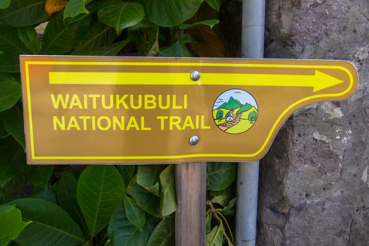
I got up and took one last shower, not knowing when I’d be able to shower again, and walked the short distance downhill to the sign indicating the start of the Segment 1. A lot of doubts entered my mind because of the lack of information about the trail. Where would I stop for the day? Segment 1 is really short so the plan was to continue onto Segment 2. Would I be able to find a place to camp?

My main doubt though, was my left knee. One month before departure, I twisted my left knee while playing my weekly soccer game. As I went to the ground, my first thought was that this trip would have to be cancelled. While in high school I had already torn the ACL on my other knee, which had since been repaired. My left knee was always the one I could always rely on, the one that never got injured. Right away it got really swollen, but I felt it wasn’t as bad as a torn ACL felt on the other one. I didn’t go to the doctor because I didn’t want to hear the bad news. As the days passed, I iced it everyday and worked very hard to get the swelling down and recover the full range of motion. Two weeks before leaving for Dominica, I did an easy 6 mile hike and, while still a little weak, the knee felt OK. I hit the gym a lot in order to recover its strength. One week before departure, I did the same practice hike again and this time it felt much better. I decided to not cancel the trip. In case I got re-injured while hiking in Dominica, I figured I would just relax and island hop around the Caribbean.

Start of Segment 1 - Waitukubuli National Trail
Start of Segment 1 – Waitukubuli National Trail
Start of Segment 1 - Waitukubuli National Trail
Start of Segment 1 – Waitukubuli National Trail
Waitukubuli National Trail sign

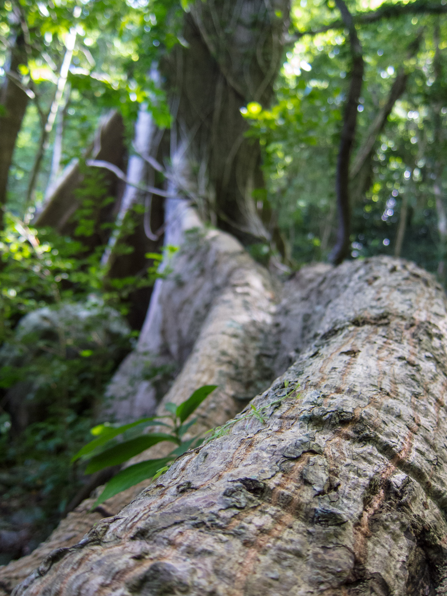
The trail starts right off with a 450 meter (1500 feet) climb of Morne Crabier. It was hot and humid and I felt very sluggish. The views were uneventful as the deep jungle didn’t let me see very far around me.

Waitukubuli National Trail Segment 1

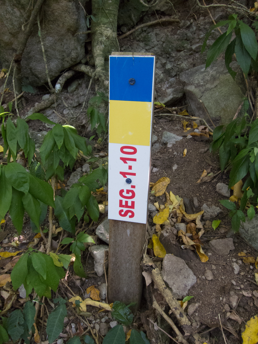
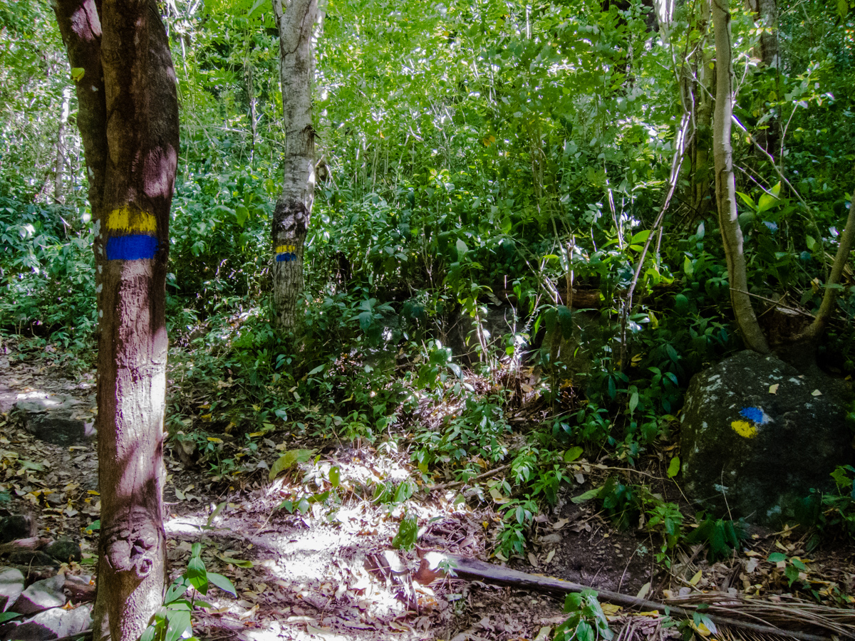
The trail is very well marked though. There are signs at every intersection, and blue/yellow paint on rocks and trees every few meters. I found out soon that the second number on the distance markers like the “1-10” below doesn’t actually represent actual distance. “1” indicates the segment, but 10 doesn’t mean anything. You just see progressively higher numbers at random intervals.

Waitukubuli National Trail trail marker

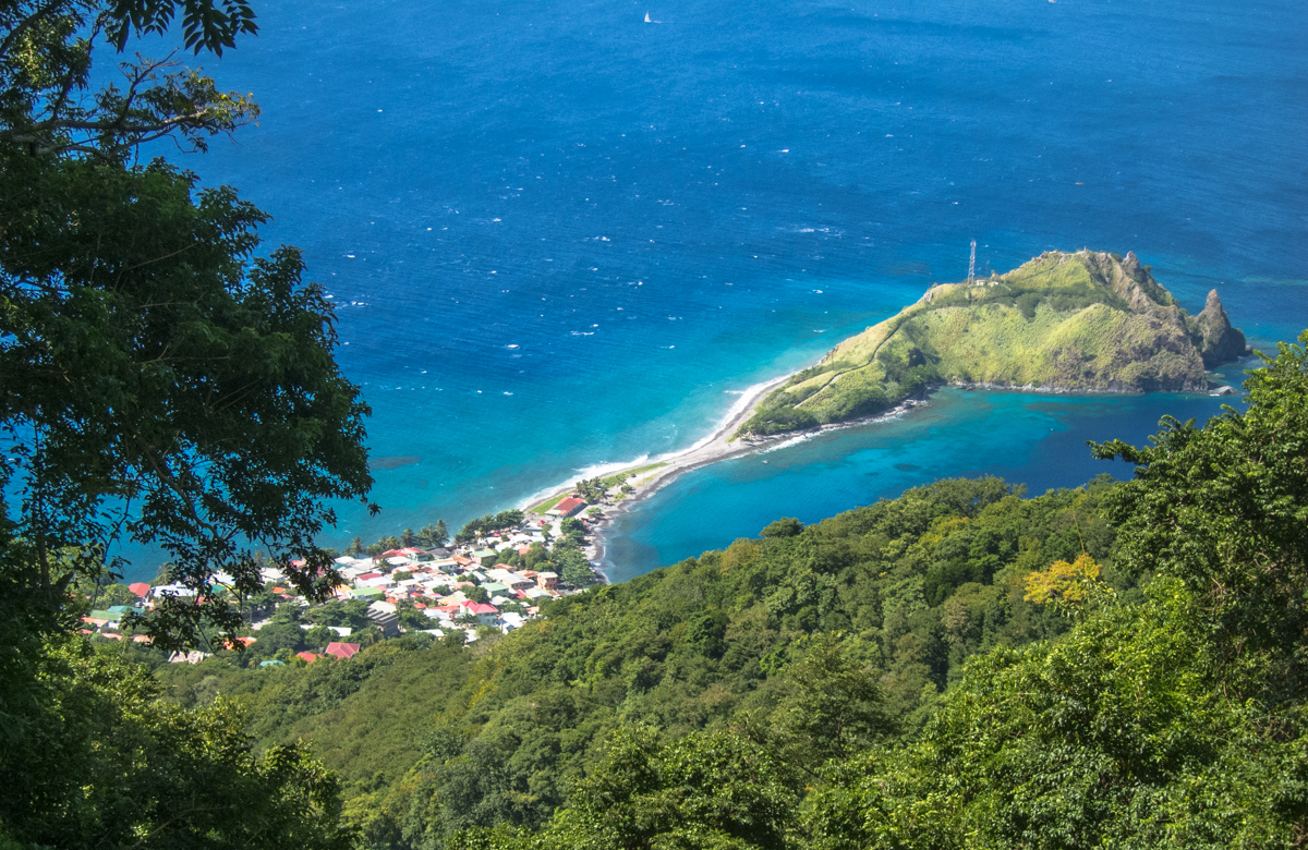
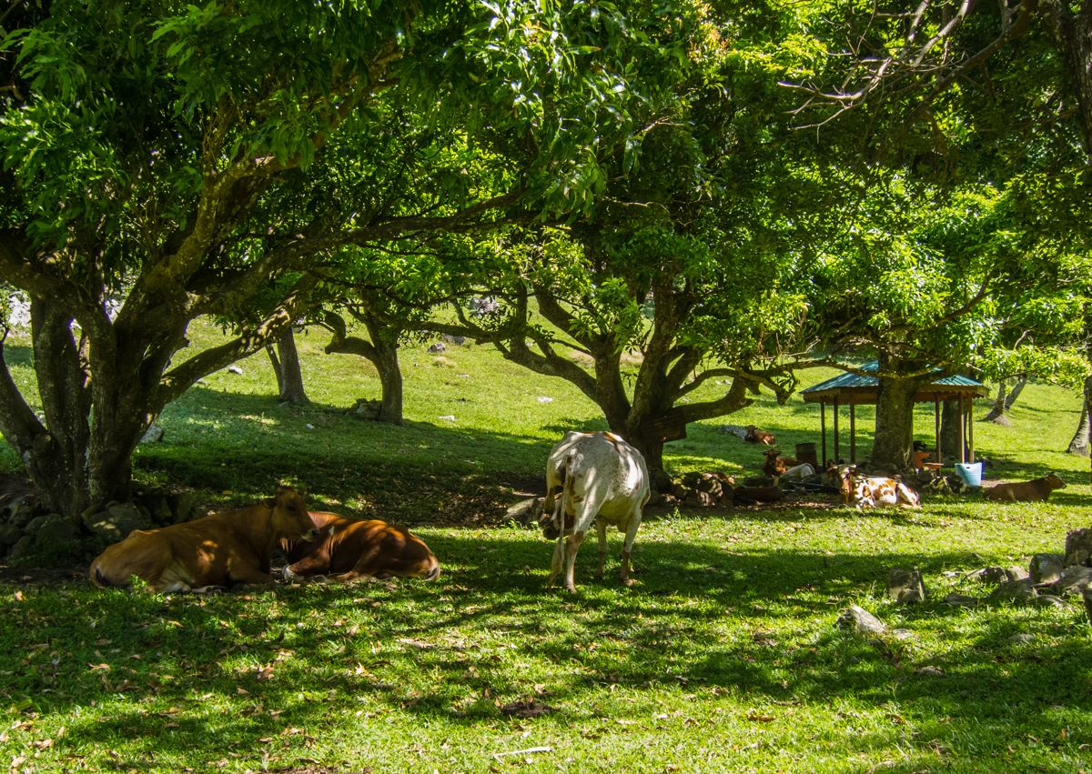
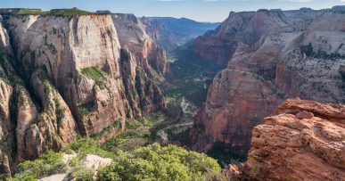
I was relieved when I arrived at the top of climb, where I found a large flat pasture with many cows. I took the picture I had seen in other places on the web, of the view looking down over Scotts Head.

Overlooking Scotts Head
Pasture on Waitukubuli National Trail

I was having a hard time figuring where the trail continued on after this pasture. It took me a while to find it because the trail sign had been knocked down, but the trail was to the left of some ruins at the other end. I tried to stick the broken sign into the ground again, but wasn’t able to.

Trail continues to the left of these ruins - Waitukubuli National Trail
Trail continues to the left of these ruins

The trail continued downhill. I was feeling a little better now. I always feel better on downhills. I met two French hikers named Greg and Ervé who were trying to open a coconut. They too were planning on completing the whole trail. We chatted for a bit and I moved on, knowing that I’d probably run into them again over the next couple of weeks.

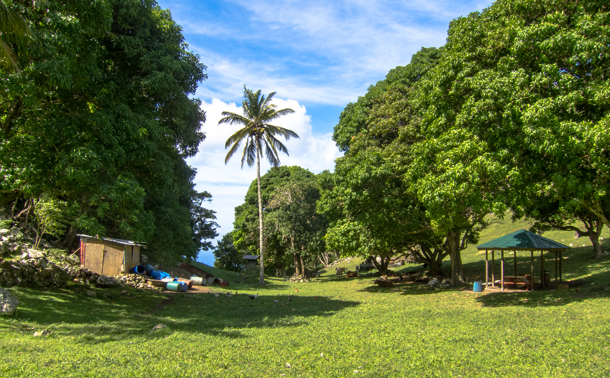
I found a few shelters that were built specifically for the WNT. These are nice shaded places to sit down and rest for a little bit.

Waitukubuli National Trail shelter
Large tree roots on the Waitukubuli National Trail

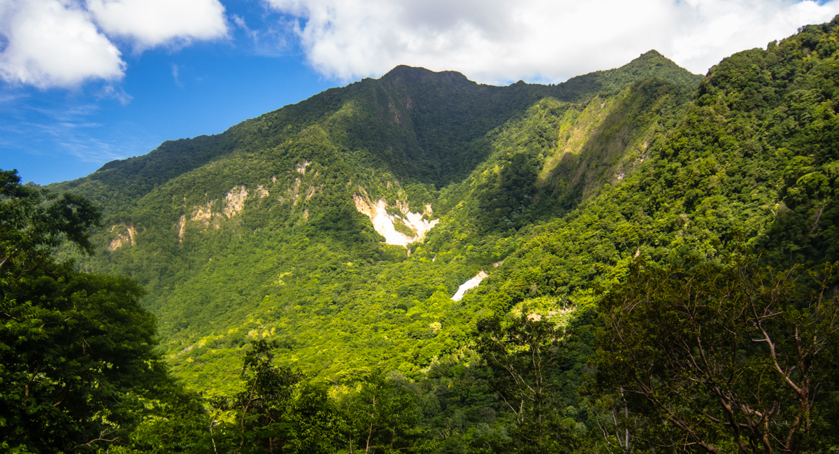
From time to time, the trail left the dense forest and I was treated to some expansive views.

Waitukubuli National Trail

The downhill became steeper before meeting up with a paved road. I passed by an old man with a machete on his hand. It’s a little shocking at first but after a while you realize that lots of people walk around with one in order to get food from the trees and the ground. I reach a T intersection where the sign tells me to make a right. The guidebook says that I should be able to buy a Dominica National Pass Site Pass, but I didn’t see anyone around selling it. I walked a couple hundred meters where I see the sign of the start of Segment 2. This is also an entrance to the Soufriere Sulphur Springs.

I was recording my progress using the Backcountry Navigation Pro app on my phone. I had downloaded the maps for the whole island beforehand, so I was able to use it even without any reception. According to the app, I had hiked 6.6 km in 3.5 hours.

Advice For Future Hikers of Segment 1

  • I didn’t find any water on the entire segment, so make sure you bring enough from the start.
  • At the end of Segment 1, you need to decide whether you want to camp somewhere around there, or hike another 4 km to Tete Morne (no camping or guesthouse available), and then leave the WNT and hike another 8 km or so to the town of Grand Bay (you might be able to catch a bus there, but not on the weekends).

Next Entry: Segment 2 – Soufriere To Bellevue Chopin
Part of the Waitukubuli National Trail Journal

Posted in Travel, Hiking, Photography, Caribbean, Dominica, Waitukubuli National Trail
2 Comments
  • Facebook
  • Twitter
  • Pinterest

Post navigation

   Prime Lens Photography Challenge – Week 4
A Busy Summer   

You may also like

Western USA Road Trip: Zion National Park

Continue Reading
Looking back at Wheeler Peak

Western USA Road Trip: Great Basin National Park

Continue Reading

Comments (2)

  • Emma January 28, 2016 at 9:02 pm Reply

    Would not consider this segment as easy …more like moderate. at a certain point you pull yourself up with a rope …buts its worth it …I’m Really satisfied . ensure that you bring water ! N your good to go

    • Kevin February 4, 2016 at 9:28 am

      You are right Emma, it’s only easy in comparison with the other segments (which are really hard), it’s definitely not a walk in a park. I remember sweating so much during the uphill climb.

Leave a ReplyCancel reply

Follow Me

  • Instagram
  • Facebook

Subscribe


Categories

  • Travel (354)
    • Round The World Trip (242)
      • Pre-Trip (20)
    • Americas (176)
      • Argentina (24)
      • Bolivia (12)
      • Brazil (20)
      • Canada (12)
      • Chile (12)
      • Colombia (9)
      • Mexico (9)
      • Peru (21)
      • United States (71)
      • Uruguay (3)
      • Venezuela (8)
    • Africa (13)
      • Djibouti (2)
      • Eritrea (6)
      • Somalia (6)
    • Asia (46)
      • Cambodia (4)
      • China (1)
      • Hong Kong (1)
      • Japan (15)
      • Macau (1)
      • Malaysia (2)
      • Mongolia (1)
      • Myanmar (10)
      • Singapore (2)
      • Taiwan (8)
      • Thailand (4)
    • Caribbean (14)
      • Dominica (14)
    • Europe (1)
      • Russia (1)
    • Middle East (26)
      • Iran (13)
      • Jordan (1)
      • Kuwait (3)
      • Oman (7)
      • Qatar (3)
      • United Arab Emirates (4)
    • Oceania (50)
      • Australia (8)
      • New Zealand (42)
  • Hiking (149)
    • John Muir Trail (31)
    • West Coast Trail (10)
    • Olympic National Park (7)
    • Yosemite National Park (10)
    • Sequoia National Park (6)
    • Angeles National Forest (2)
    • Ansel Adams Wilderness (5)
    • Bryce Canyon National Park (1)
    • Chapada Diamantina (1)
    • Death Valley National Park (1)
    • King's Canyon National Park (8)
    • Mount Roraima (3)
    • New Zealand Great Walks (33)
    • Salkantay To Machu Picchu (9)
    • Torres del Paine (6)
    • Waitukubuli National Trail (11)
    • Zion National Park (2)
  • Motorcycle (12)
  • Photography (286)
  • Train Rides (14)
  • Life (15)
  • Other Stuff (2)

Archives

  • 2020 (2)
    • April (2)
  • 2019 (5)
    • July (2)
    • June (3)
  • 2018 (10)
    • May (2)
    • March (4)
    • February (1)
    • January (3)
  • 2017 (34)
    • December (1)
    • September (1)
    • May (1)
    • April (4)
    • March (12)
    • February (10)
    • January (5)
  • 2016 (47)
    • November (1)
    • October (4)
    • September (6)
    • August (4)
    • July (2)
    • May (2)
    • April (8)
    • March (11)
    • February (3)
    • January (6)
  • 2015 (75)
    • December (1)
    • October (6)
    • September (2)
    • August (5)
    • July (8)
    • June (7)
    • May (9)
    • April (13)
    • March (13)
    • February (6)
    • January (5)
  • 2014 (80)
    • December (2)
    • November (5)
    • October (6)
    • September (9)
    • August (7)
    • July (6)
    • June (10)
    • May (17)
    • April (5)
    • March (4)
    • February (4)
    • January (5)
  • 2013 (27)
    • December (4)
    • November (2)
    • October (6)
    • September (2)
    • June (1)
    • May (5)
    • April (3)
    • March (2)
    • January (2)
  • 2012 (14)
    • December (3)
    • November (5)
    • September (1)
    • August (2)
    • June (1)
    • March (1)
    • February (1)
  • 2011 (18)
    • December (1)
    • November (2)
    • October (2)
    • September (2)
    • August (1)
    • July (1)
    • May (1)
    • April (6)
    • March (1)
    • January (1)
  • 2010 (28)
    • December (4)
    • October (2)
    • September (1)
    • August (3)
    • July (7)
    • May (3)
    • April (2)
    • March (3)
    • January (3)
  • 2009 (22)
    • December (6)
    • November (3)
    • October (1)
    • September (5)
    • August (2)
    • July (2)
    • June (1)
    • March (1)
    • January (1)
  • 2008 (4)
    • November (2)
    • May (1)
    • March (1)
  • 2006 (4)
    • November (1)
    • February (1)
    • January (2)

kevinstravel

Rough race and not the result I was looking for. W Rough race and not the result I was looking for. Was targeting a sub 2:55 but finished in 3:31. It felt hard from the start and had stomach issues later on. Still proud of the effort and finish.
2 more days 2 more days
Tiruchirappalli, India. January 2018. Tiruchirappalli, India. January 2018.
Kerala, India. January 2018. Kerala, India. January 2018.
Load More Follow on Instagram

996 Days Traveled
33 Countries Visited
290 Beds Slept In
79 Flights Taken
180 Buses Long Distance
93 Trains Long Distance
48 Boats Survived

© 2006-2023 Kevin's Travel Blog. All Rights Reserved.